Welcome to GCDroid
create topics and leave suggestions for new feature
Willkommen zu GCDroid
erstelle Themen und hinterlasse Vorschläge für neue Funktionen

 Submit any waypoint as Corrected coordinate via the API
When doing a Multi or other geocache with multiple steps I usually add a new waypoint for each step. Seldom do I know when it was the last step and my final waypoint in GCDroid could then be named something like "step 7".
I then want to save that Final to Geocaching.com for future use, to see cache collisions for example. As it works today, I need to read the coordinates from my last waypoint, edit the "original" and add them there, and submit online.
I would like to be able to push any waypoint to Geocaching.com as corrected coordinates to simplify this flow.
Option to purge unused cached map tiles
I really love that GCDroid caches map tiles. I currently have over 3 GB of map tiles cached in my phone, which is quite a lot.
The downside is of course the size of the data. I would suggest saving a timestamp of when each tile was last used, and an option to (automatically, or manually) remove tiles not accessed in X days. I figure X would be useful as anything between 30 and 500 days.

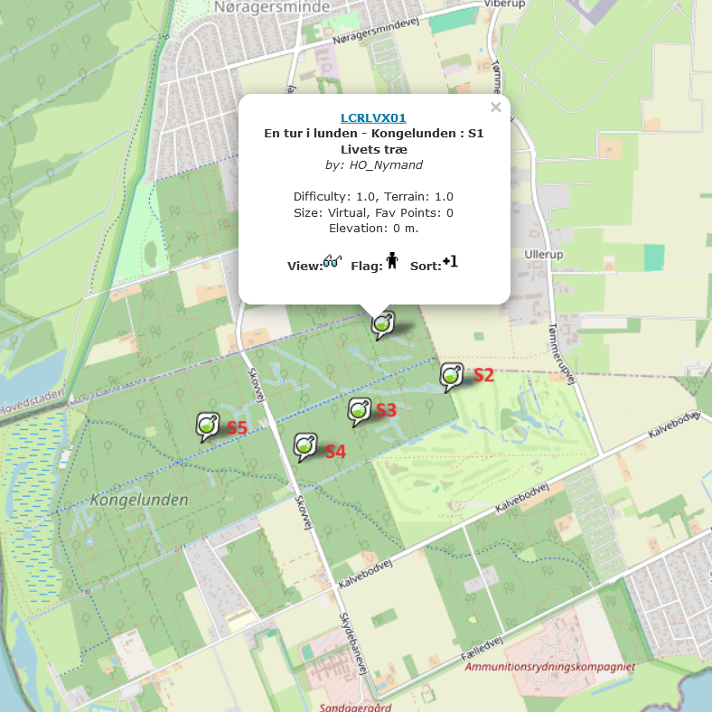
Load all waypoints from a labcache series
At the moment GCDroid only loads the place, where the Lab is set.
It would be nice to load all waypoints of a labcache round.
On https://gcutils.de/lab2gpx/ you can load gpx files, with all waypoints.
Example:
Lab2gpx
GCDroid

 Probleme mit Offline Karten
Ich verwende GCDroid mit Offlinekarten von OpenAndroMaps.
Seit geraumer Zeit kann ich aber keine neueren Karten mehr einspielen, weil die V5 Karten bei mir nicht richtig dargestellt werden.
Wenn ich dagegen die V3 Karten vom September 2019 verwende, dann funktioniert alles wunderbar.
Ich habe zur Verdeutlichung zwei Screenshots mit exakt dem selben Kartenausschnitt unten angehängt.
Mache ich was falsch, oder wird V5 einfach nicht unterstützt?
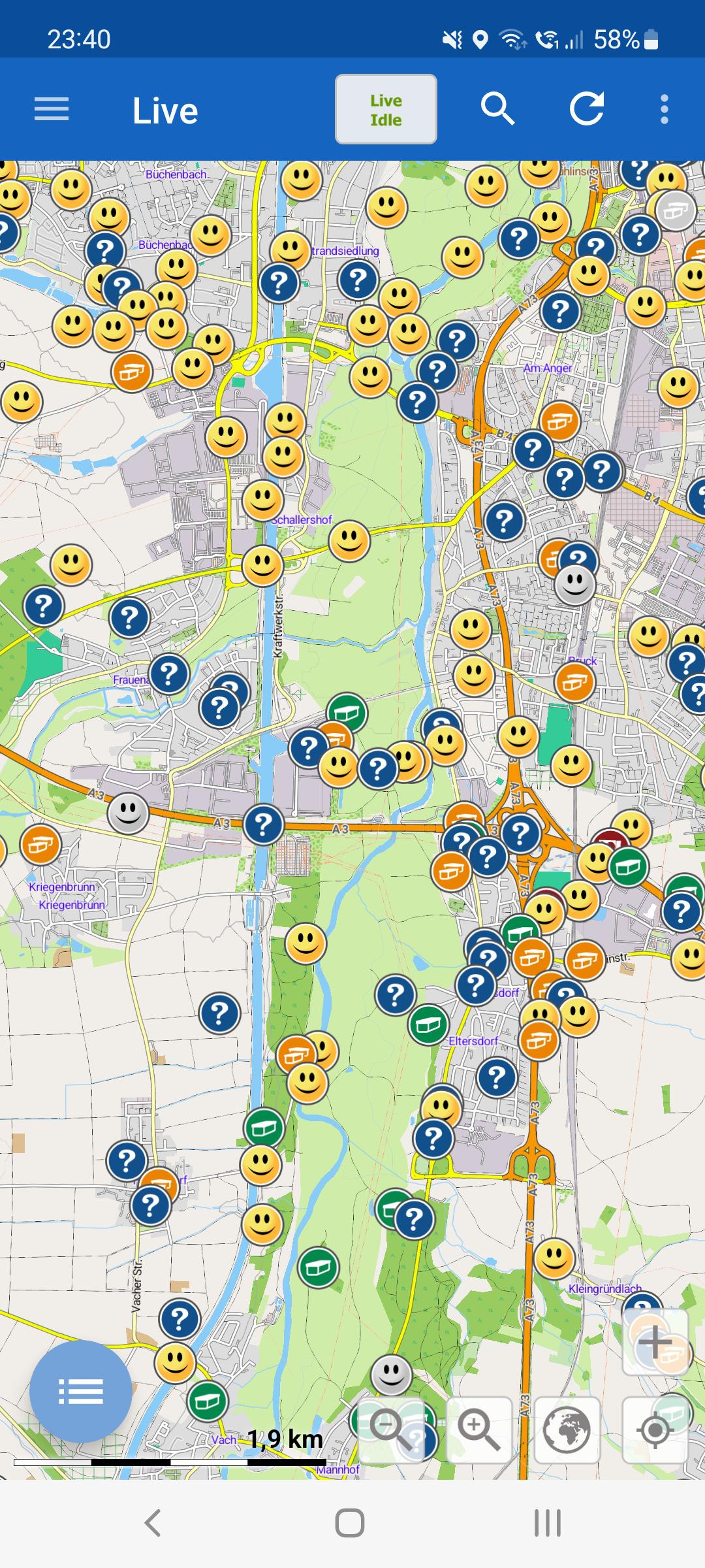
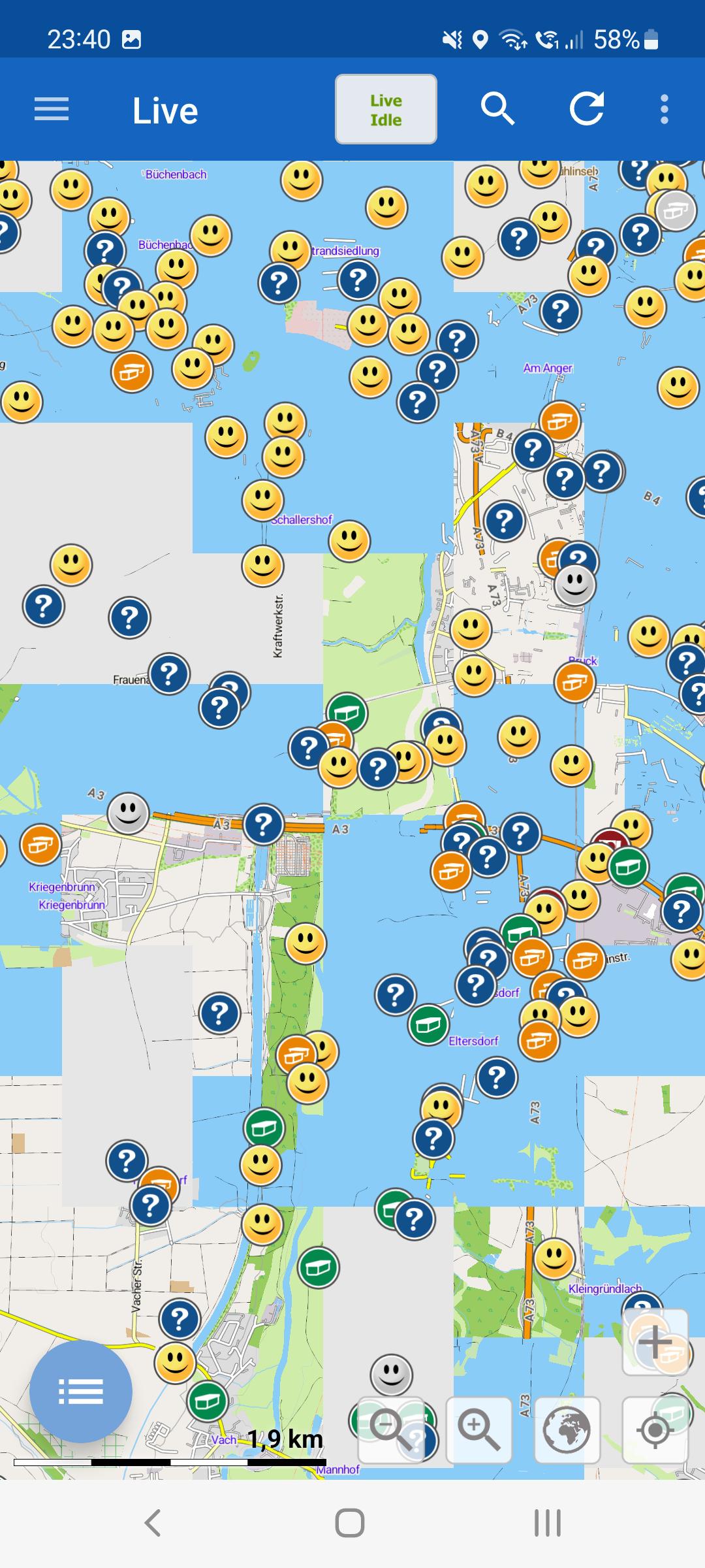


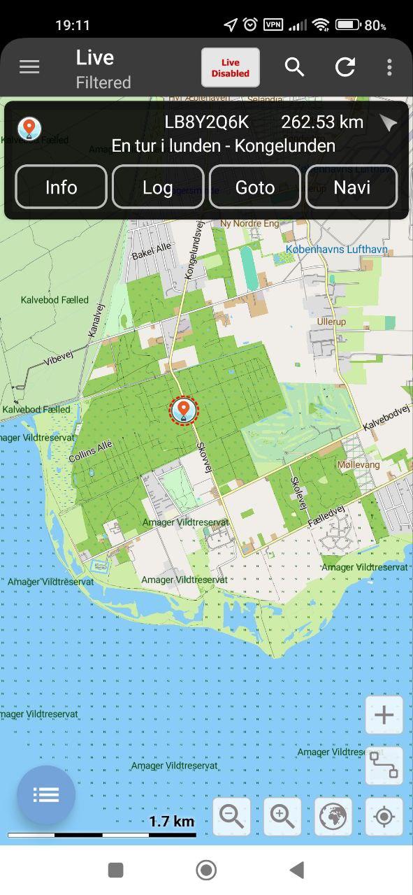
Live map loading from a larger zoom distance
Currently, the Live map works only when you zoom the
map to a certain level, in any other case the map is "Live paused".
When I bought the app I was really confused, now I'm used to it but I
never liked how it works. I would love to have an option to load caches
from further away. I know that's something different, but I would use c:geo as a reference, where all caches load regardless of the zoom. I guess (hope) there is no limitation on that from the API side?
I often plan where to go next (on bigger distances), and the only way
to do that, is to zoom out (very far) activate normal search and copy
all caches to offline DB. That is not convenient on short trips, or when
the plans change. Actually, this is never convenient ;)
So I would propose a setting, where you can change the zoom level required to activate "Live map". I know it may get laggy sometimes, but I'm still in favor of that - I like to see where I can go, being able to load caches in a whole city with one refresh of the Live map, and not having to zoom to different districts. That's one of the things that bothers me for some time already. The default setting could be as it is now, so it wouldn't change anything for others who like how it is.
Edit:
To be more precise I've recorded a short video. I'm being zoomed out a little bit more, and can't see any caches (and I would love to see!). I have to go very deep to be able to see anything. That's just frustrating.


 Corrected Coordinates lost on refresh
When I go to waypoints and correct the coordinates (same when using a GSAK DB with corrected coords) and then use refresh in GCDroid this correction including the new coords are lost
From my point of view a correcteion should not be lost during an update is it is localally and not on gc.com. Only the listing original coords and waypoints (not user related) should be updated

Favorite points as a percentage
Please check again whether the API now supports the additional display of the voting percentage

Höhenlinien und andere Objekte auf der Karte einblenden
Aktuell scheint keine Funktion vorhanden zu sein, dass man die Höhenlinien auf der Karte erkennen kann. Betrifft die Offline- wie auch die Onlinekarten.
Ich kenne das von den Mapsforge Maps mit passendem Theme, da kann man aktuell auswählen, was man auf der Karte sehen möchte. Ist der Haken im Theme gesetzt, dann kann man die auch sehen.
Fände sowas total praktisch bei längeren Touren.
Es gibt ja eine Möglichkeit bei anderen Apps die diversen Inhalte auf der Karte, die man gerne sehen möchte (u.a. Höhenlinien, Sitzbänke, spezielle Wege/Objekte usw.) einzublenden. Ich fände es schön, wenn es hier auch möglich wäre.
trackable - Vorlagentexte anlegen können
z.b.
Gesehen auf dem Giga in Hamburg.
Customer support service by UserEcho
