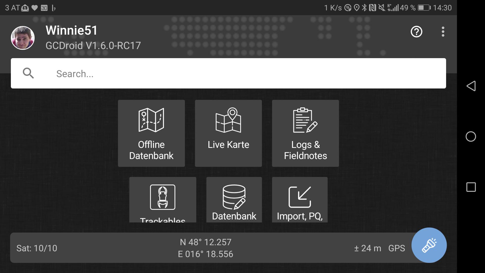
Welcome to GCDroid
create topics and leave suggestions for new feature
Willkommen zu GCDroid
erstelle Themen und hinterlasse Vorschläge für neue Funktionen

 es ist nicht aufzuhalten... das grüne Herz...

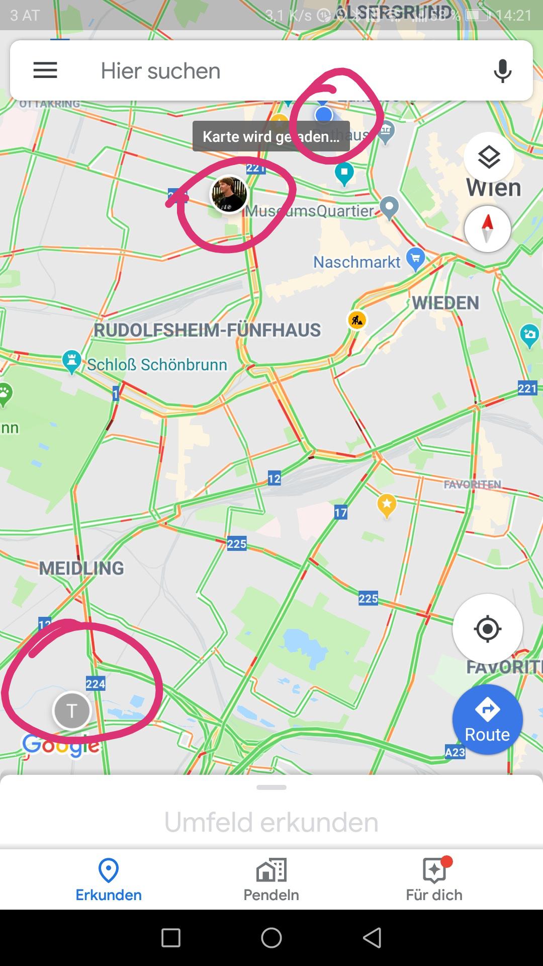
Meet & greet (view other cachers)
Vor allem am Weg zu FTFs oder Events wurde ich mich immer wieder freuen zu sehen, (ob und) wo sich gerade weitere Kolleginnen und Kollegen befinden. In den Einstellungen kann man seine Sichtbarkeit für andere de/aktivieren und auf der Karte andere Cacher anzeigen lassen. Ähnlich wie bei Glympse, Waze oder der Google Standortfreigabe.
Das non plus ultra wäre dann auch noch eine direkte chat Funktion.

I guess due to the big implications on privacy rules AND the fact that it is a great amount of work I'll close that for now...

Translating caches
I'm English speaking living in German speaking Switzerland on the border with France. I love to go geocaching but my language skills aren't up to translating all the details. It would be very useful to be able to translate caches. I found a way but it only does part if it stopping before the important bits and won't do logs. It would make it a little easier. With this I would also be able to do puzzle and multi caches which I can't vat the moment.

 GCDroid closes when clicking on link, if orientation not set to "Auto (Device)"
Setting the orientation (Settings/General/Orientation) to "Portrait" or "Landscape" causes GCDroid to stop with an error message when clicking on a cache link from an email or text message.
On my phone (Moto Z2 Force, Android 8.0) this is repeatable. Changing the orientation setting back to "Auto" immediately fixes the problem and I can click on geocache links again, and open them up in GCDroid.
Verbesserung Erkennbarkeit Untermenü Koordinaten
für Peilung, ändern etc.
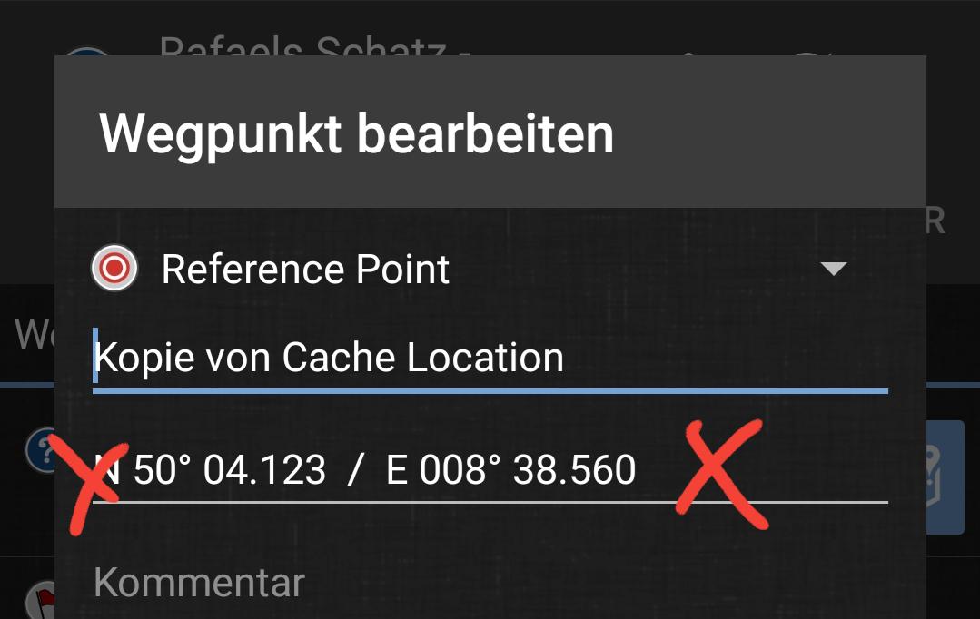
Koordinaten mit Distanz und Richtung aus Waypoint berechnen
Aus den Header Koordinaten heraus kann man Distanz und Richtung zum korrekten Final errechnen:
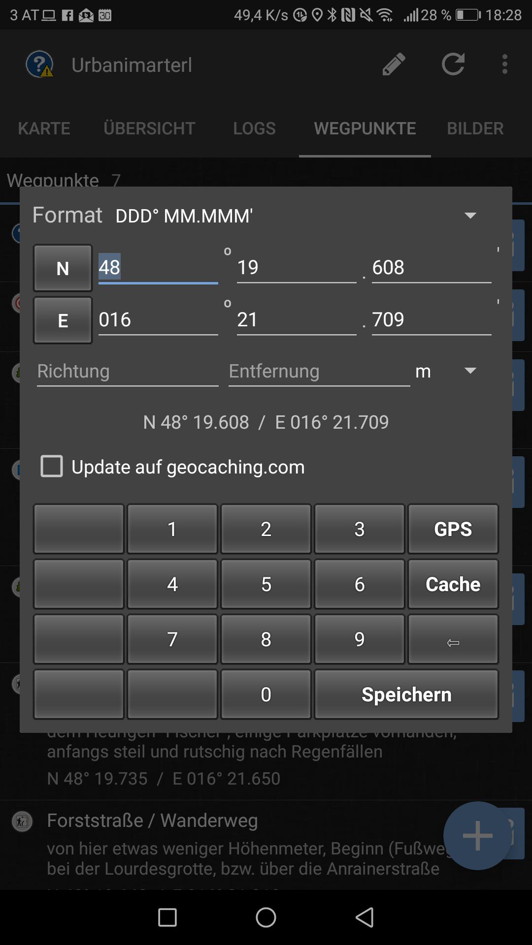
Bei einigen Caches ist es aber so, dass man von einem Refernzpunkt aus peilen muss. Diese Peilung ist aktuell nicht möglich:
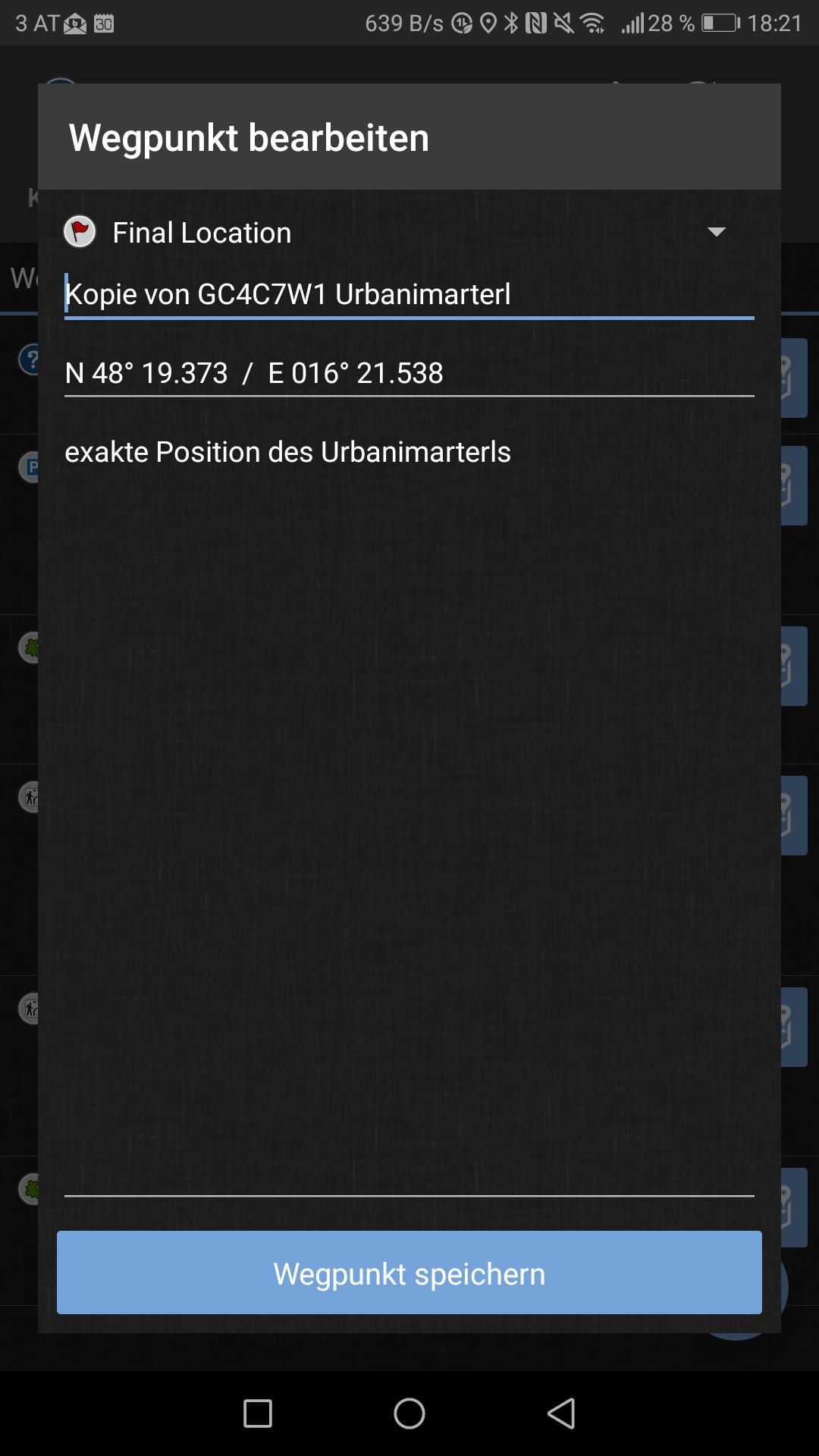
Es wäre wünschenswert die Peilung in allen Waypoints zu ermöglichen.
Querformat Darstellungsfehler
Die Trackables haben scheints irgendwo einen Zeilenumbruch zu viel.
ja und nein.... ein Dashboard das auf allen Displays mit allen Aufloeung in allen Sprachen funktioniert ist fast nicht moeglich.
Alle Button in der unteren Reihe sind abgeschnitten, ABER daher gibt es ja das Feature: Change Layout (3 punkte menue).
Dort kannst du die Button groesse, etc einstellen. Die Einstellung ist fuer Hoch/Quer GETRENNT!
Mit OK bestaetigen, Telefon drehen und dann die andere Ansicht einstellen....
Sieht also zwar nicht aus wie ich es will aber genau dafuer hab ich das neue Feature eingebaut...
in technical terms the live maps loads at zoom level 14 I believe... in simple terms: zoom in until the icon changes from paused to either idle/loading.
I will keep loading as you pan the map

 Googlemaps text size
No the tiles are bitmaps and as such there is no way to scale parts of it.
Customer support service by UserEcho
